.JPG)
Back in early October 2022 I headed to the Hawkes Bay for a short holiday. While travelling across the Napier to Taupo Road I stopped off at Eskdale. Eskdale holds a very special place for me as I spent many summer holidays as a young lad at the nearby camping ground. Never in my wildest dreams could I imagine that only five months later Eskdale would be a scene of devastation due to flooding caused by Cyclone Gabrielle.
Opened on the 23rd of July 1923, Eskdale is located north of Napier at the 197km post on the Palmerston North to Gisborne Line (PNGL).
In its day it was a busy little country station serving the local rural community and was a crossing place for passenger and goods trains heading to Gisborne and returning to Napier and points south.
Opening of the Eskdale Railway Station sometime in the early 1920's. Photo courtesy of the Old Hawkes Bay Facebook page www.facebook.com/groups/oldhawkesbayOriginally, Eskdale's track layout comprised of the main, a crossing loop, a siding, a goods siding and a back shunt for the stock yard. Buildings comprised of a station building, goods shed, loading bank, water tanks and stock yard.
Eskdale Railway Station in 1924 looking east towards Napier. France House can be seen in the middle left of the photo. Photo by Albert Percy Godber. Photo courtesy of the National Library. natlib.govt.nzThe Esk Valley and Eskdale are no strangers to natural disasters. At 10:47am on the 3rd of February 1931, a magnitude 7.8 earthquake struck the Hawkes Bay. The earthquake killed 256, injured thousands and devastated the Hawkes Bay. Transport infrastructure including the railways were significantly damaged and the station was closed due to earthquake damage. At the time of the 1931 earthquake, the railway line to Gisborne was still under construction and had not yet reached Wairoa.
Eskdale River Bridge following the 1931 Hawkes Bay Earthquake. Photo taken by John Cormick. Photo courtesy of MTG Hawkes Bay collection.mtghawkesbay.comThe station reopened on the 23rd of August 1937 only to be significantly damaged by flooding in April 1938.
The line from Napier to Gisborne was finally completed and opened for traffic in 1942.
J class 4-8-2 Steam Locomotive 1234 leads a Gisborne bound goods train away from Eskdale. The photo was from the New Zealand Railways Publicity Branch in 1956. Photo courtesy of the Knowledge Bank - Hawkes Bay Digital Archives Trust. Knowledge.org.nz
DC 4070 arrives at Eskdale with a Napier bound Goods Train 961 on the 10th of June 1980. Photo by P. Kerwin. Photo courtesy of the Old Hawkes Bay Facebook page www.facebook.com/groups/oldhawkesbay
Eskdale was closed to all traffic on the 30th of March 1985 but remained in use as a crossing loop and for the storage of written off wagons. Most of the old infrastructure including the goods shed, station building and signals were removed around this time. Later on the siding, goods shed siding and back shunts were removed leaving only the station platform, shelter station and loop siding.
As children, my brother and I often went on holiday with my grandparents at the Hawkes Bay Caravan and Camping Club camping ground at Eskdale. I remember badgering grandad to take me to the station. One day we finally did get to walk to the station. Memories are a bit blurry but I do recall seeing an old white four wheel wooden insulated wagon on one of the sidings. It was only later I found out that this wagon was W1152, a W class wooden insulated meat wagon. W1152 was refurbished in the early 1980's and painted in a special livery to mark the centenary of the first frozen shipment of meat from the Port of Napier.
Insulated 4 wheel meat wagon W1152 in a faded special Nelson Brothers Tomoana Freezing Works livery at Ormondville. Courtesy of the NZR in OO page nzr.lolshame.com
Since this wagon holds such a special place in my memory I might do a post dedicated to this old wagon.
Freight trains continued to use the line until March 2012 when a storm caused four large washouts north of Wairoa. The line was then effectively mothballed until late 2019 when log trains resumed running between Napier and Wairoa. Initially the log trains ran in the weekends but as demand grew these services began running on weekdays.
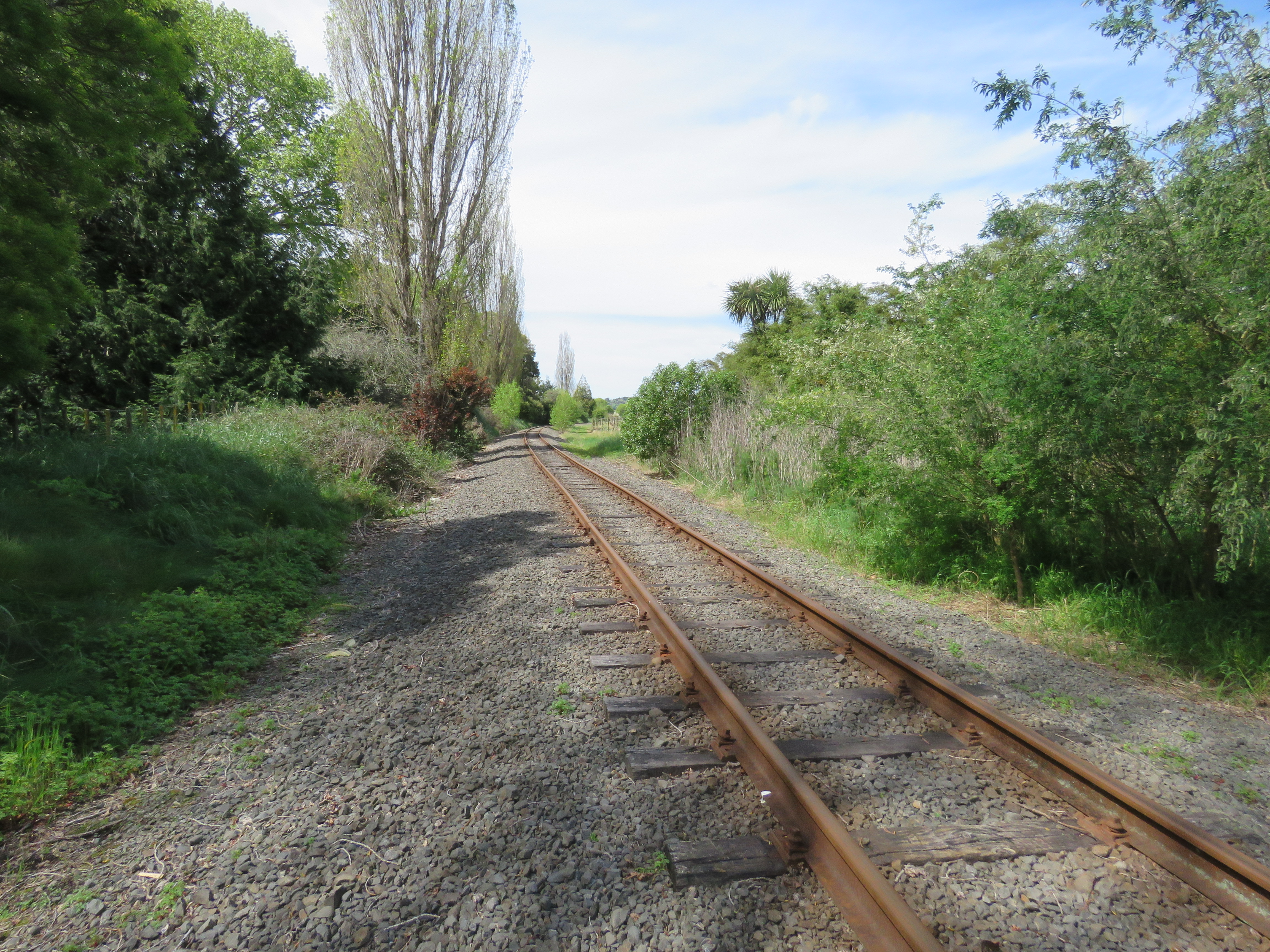
The PNGL line looking eastwards towards Napier from the eastern end of the Eskdale Siding. 5/10/2022.
The points at the Napier end of the Eskdale Siding. The sign gives the location and identifies that the loop is a siding with manually operated points. 5/10/2022.
The points for the Eskdale siding at the Napier end of the siding looking west towards the station shelter. 5/10/2022.
The 197 Kilometer marker post at Eskdale. This marker is 197km's from the start of the Palmerston North to Gisborne Line at Milson Junction in Palmerston North. 5/10/2022.
The Napier end of the siding. The siding is overgrown and doesn't see any use. An open derailer can also be seen. 5/10/2022.
Looking West towards the Shaw Road railway crossing. 5/10/2022.
Shaw Road Railway Crossing looking south towards State Highway 5, the Napier to Taupo Road. 5/10/2022.
Shaw Road Railway Crossing looking north. The railway crossing provides access to Hukarere Girls College and Eskdale Park. Shaw Road was named after Hazel and Les Shaw who ran France House at this location. 5/10/2022.
The PNGL looking east from Shaw Road towards Napier. 5/10/2022.
Looking west from the Shaw Road railway crossing towards the Eskdale station shelter. 5/10/22.
Eskdale yard looking towards the Shaw Road railway crossing. 5/10/2022.
Eskdale yard looking towards the station shelter. 5/10/2022.
Due to its location near a good swimming river and proximity to Napier and Hastings, Eskdale become a popular destination for picnic trains for railway workers and freezing works staff. The station had also become a popular stop for excursion trains.
The current shelter station and railway precinct has been restored and well looked after by local railway enthusiasts. Much of the work was lead by Spud Langley who has been responsible for restoring many railway structures around rural Hawkes Bay. An article about Spud and his work can be found here.

Eskdale Station. 5/10/2022.
A marker post showing the distance by rail from Eskdale to Napier and Gisborne. 5/10/2022.
The Eskdale Station Shelter. Napier end. 5/10/2022.
Eskdale Station Shelter from the front. 5/10/2022.
Eskdale Station Shelter. Gisborne end. 5/10/2022.
The western end of the Eskdale yard looking towards the station shelter. Another open derailer on the siding. 5/10/2022.
Eskdale yard looking towards Waipunga Road railway crossing at the Gisborne end of the yard. The western end of the old yard is now used by roading contractors to store metal chip. 5/10/2022.
The siding looking towards Waipunga Road railway crossing at the Gisborne end of the yard. 5/10/2022.
The siding points at the Gisborne end of the siding. 5/10/2022.
The points for Eskdale siding at the Gisborne end of the yard. This view is looking towards the station shelter. 5/10/2022.
Something that can still be seen around New Zealand is the short fencing made of old rails . These fences were located at both sides of a railway crossing and were used alongside cattle stops to stop livestock from getting onto the railway right of way. 5/10/2022.
Waipunga Road railway crossing looking towards the Napier Taupo Road. 5/10/2022.
On the Gisborne side of the Waipunga Road railway crossing I found this sign on the lineside. Its not one I've seen before. 5/10/2022.
The PNGL looking west towards Gisborne from the Waipunga Road railway crossing. 5/10/2022.
In the early hours of Tuesday the 14th of February 2023, flooding ripped through the Esk Valley resulting in death and destruction in the quiet community of Eskdale. The flooding was the result of huge amounts of rain that fell in the area as Cyclone Gabrielle moved its way along the East Coast of the North Island.
Sadly the railway was also severely effected with the railway yard covered in thick deposits of silt and parts of the platform washed away.


The Eskdale Railway Shelter following Cyclone Gabrielle and flooding in the Esk Valley. Photos by Geoff Mackley and Matthew Davison. Photos courtesy of the Railways and Tramways of New Zealand Facebook page Railways and Tramways of New Zealand
Rail infrastructure across the Hawkes Bay was significantly damaged by Cyclone Gabrielle with many slips, embankments washed away and numerous bridges damaged or destroyed. It's unlikely trains will be rumbling by the small green and cream station shelter in Eskdale for sometime to come.




.JPG)
.jpg)


%20Nelson%20Bros%201%20Ormondville%2014SEP2012.jpg)

.JPG)


.JPG)

.JPG)
.JPG)


.JPG)


