Showing posts with label Branch Lines. Show all posts

Sunday, April 9, 2023

Station Profile - Ngapuna


Ngapuna is located 70km from the junction at Wingatui and was the first station past Middlemarch on the Otago Central Railway. It is now a stop on the Central Otago Rail Trail.

In the early days of European settlement, the Strath Taieri was developed for dairying but later transitioned to sheep and beef farming, which remains the primary industry in the area. 

To help open up the interior of Otago and assist farmers in transporting their goods to market, construction of a railway between Wingatui and Cromwell began in 1877. Ngapuna Station opened on the 12th of July 1894.

The station was originally named 'Springs' after the fresh water spring in the area, however in 1910, the local Maori translation, 'Ngapuna' (The Spring) was adopted.

Ngapuna was a simple station consisting of a station shelter, a short siding with a low loading bank and a backshunt with stock yard.  

The loop had a capacity of 10 wagons while the backshunt had capacity for 16 wagons. 


A memo dated the 14th of July 1914 from the Dunedin District Engineer for improvements to Ngapuna's station yard. Archives New Zealand - Dunedin Office.

The main traffic at Ngapuna was livestock, wool, lime and manure. Ngapuna provided a vital transportation link for local farmers who received lime to fertilise their farms and shipped large numbers of sheep, lambs and cattle to Burnside and other freezing works in Otago and bales of wool to the large wool stores in Dunedin.


Ngapuna looking towards Hyde. Photo from the G.W. Emerson Collection and can be found at the Otago Central Rail Trails Trust Railtales website here.

Steam locomotive Ab 782 shunts the stock siding at Ngapuna before continuing its journey to Middlemarch and onwards to Dunedin. This photo is from the G.W. Emerson Collection and can be found at the Otago Central Rail Trails Trust Railtales website here.


Ab 792 shunts a Cromwell bound down goods train at Ngapuna on the 6th of January 1964. Photo taken by Weston Landford https://www.westonlangford.com/images/photo/103849/ 

Ab 792 shunts a JC sheep wagon at Ngapuna on the 6th of January 1964. Photo taken by Weston Landford https://www.westonlangford.com/images/photo/103850/

Such was the number of animals shipped from Ngapuna, the stockyards were often not large enough for the traffic. Mobs of sheep and herds of cattle were often held on Ngapuna Road while the stock in the two pens were loaded onto wagons. This caused some angst amongst local farmers who requested improvements to the stockyards.

A memo dated the 27th of November 1963 between the District Traffic Manager and the District Engineer requesting alterations to the existing stock yard at Ngapuna. Archives New Zealand - Dunedin Office. 

By the late 1970's, the New Zealand Railways were losing livestock traffic to road haulage which provided a more efficient farm to works service. With the siding needing costly repairs and livestock traffic declining, a proposal was made to close Ngapuna.

 A letter from the District Traffic Manager to the Strath Taieri Branch of Federated Farmers advising them of the proposed closure of Ngapuna. 25 July 1979. Archives New Zealand - Dunedin Office. 

The Strath Taieri Branch of Federated Farmers and the Silverpeaks County Council were quite vocal in their opposition to the proposed closure of the station. At the time New Zealand was in the midst of the second oil shock. Local farmers wanted the siding to remain in case the oil crisis worsened, road transport became uneconomic and they needed the railways to transport their livestock and deliver their lime.

Memo from the Dunedin District traffic Manager to the Chief Traffic Manager following the meeting between representatives from the Federated Farmers, NZR and Silverpeaks County Council to discuss the closure of Ngapuna. 8 November 1979. Archives New Zealand - Dunedin Office.

Despite the opposition, Ngapuna was closed to all traffic on the 23rd of December 1979. All the facilities remained but the mainline turnouts were removed. In 1981, the station shelter and stockyards were sold and the remaining siding tracks lifted.

Following the completion of the Clyde Dam, the last major traffic source on the line disappeared and the Otago Central Railway was closed on the 30th of April 1990. Demolition of the line started in December 1990 and was completed in December 1991. The section between Wingatui and Middlemarch remains in use as a tourist railway operated by Dunedin Railways. The railway right of way between Middlemarch and Clyde was converted into a cycle trail and is now a hugely popular tourist attraction. 

With the promise of fine weather I visited Ngapuna on Saturday the 8th of April 2023. This station has always been a favourite of mine due to it's rural scenery and because the small station shelter has been returned to its rightful place.

Ngapuna railway station can be accessed by road either by turning off at State Highway 87 Hyde - Middlemarch Road onto Ngapuna Road at Rock and Pillar or turning off State Highway 87 Hyde - Middlemarch Road onto Ngapuna Road north of Middlemarch. Better still, cycle the 6km from Middlemarch on the Otago Central Rail Trail. 

At Ngapuna you will be greeted by a well kept station precinct including the old railway fence and gate.

Ngapuna Railway Station. 8/4/23.

I made my way to the Middlemarch end of the station area and began to work my way north. The first piece of infrastructure I came across was a stone culvert. These stone culverts were common all along the Central Otago Railway and most are still in place along the rail trail. A true credit to the stonemasons that built them.


A stone culvert at the Middlemarch end of the station.  8/4/23.

Next I came across a concrete marker peg. This is the 70 kilometer marker showing this location is 70 kilometers from the junction at Wingatui. This concrete marker looks very new and is unlikely to be the original.

The 70Km marker peg at Ngapuna. 8/4/23.

A little further north of the marker peg was the remains of the old wooden low level loading bank. This loading bank was next to the short siding and the remaining part is still in very good condition.


The remains of the low loading bank at Ngapuna. 8/4/23.


Looking past the low loading bank towards Middlemarch. 8/4/23. 

Next up was the station shelter. The 14 foot by 9 foot station shelter at Ngapara is a standard NZR design and has been restored to a high standard. The station shelter was sold and removed in 1981. It was later returned to the station site after the old railway line was turned into a rail trail. I absolutely love this building.

A 3/4 shot of Ngapuna Station Shelter. 8/4/23.

The front of the Ngapuna Shelter Station. 8/4/23.

Another 3/4 shot of Ngapuna Station Shelter. 8/4/23.


The Hyde end of the Ngapuna shelter. 8/4/23.

Rear of the station shelter showing the wires securing the shelter to the fence. The Strath Taieri can have some very strong winds so protecting and securing light structures are a must. 8/4/23.


The Middlemarch end of the Ngapuna shelter station. 8/4/23.

The interior of the shelter remains in good condition but you can tell starlings love to nest inside. Its good to know this building still provides shelter to cyclists when its wet and windy.

Interior of the station shelter. 8/4/23.

The Otago Central Railway Trail Trust are very good at installing information boards along the length of the rail trail and Ngapuna is no different. An information board in the shelter describes the history of skiing on the Rock and Pillar Range.

The Rock and Pillar Skiing information board inside the Ngapuna station shelter. 8/4/23.

Ngapuna Station looking towards Hyde, 8/4/23.


Ngapuna Station looking towards Middlemarch. 8/4/23.

To the north of the station was the former location of the stockyards and backshunt. The flat area where they were located is still visible.


Location of the former backshunt and stockyard. 8/4/23.

With the low cloud and fog clearing I was able to use my drone to get some overhead views of Ngapuna. 


Ngapuna Railway Station. 8/4/23.


Ngapuna Railway Station and the rail trail as it heads towards Middlemarch. 8/4/23.

I was also able to get my first flyovers of a forgotten station.


Flyover from the Middlemarch end to the Hyde end of Ngapuna Station. 8/4/23.


Flyover from the Hyde end to the Middlemarch end of Ngapuna Station. 8/4/23.

This was the first time I've used a drone to capture overhead photos and video for one of my blog posts. The versatility of these machines is incredible and I'm looking forward to getting some different views of stations and railway infrastructure.

With time ticking and my work phone starting to ring it was time to leave but not before I got this last shot of the Ngapuna station shelter with the tops of the Rock and Pillars breaking through the low cloud.


Ngapuna station shelter with the Rock and Pillar Ranges. 8/4/23.

And that's about it.

Information for this station profile came from the Dunedin Office of Archives New Zealand, the Otago Central Rail Trail Trust website which can be found here. 

Monday, April 12, 2021

Light at the end of the Tunnel - Rakis Tunnel on the Tokarahi Branch


Interior of the Rakis Tunnel.

Returning from a work trip up the Waitaki Valley I decided to take a short detour to explore the Rakis Tunnel. 

The Rakis Tunnel is one of two tunnels on the former Tokarahi Branch. The Tokarahi Branch left the Ngapara Branch at Windsor. Construction of the 19.22 branch started in June 1879 and was opened for traffic in July 1887. The branch had a short life and closed in July 1930. 

Above the tunnel is the significant flat top feature called the Rakis Table. The Rakis Table is made of Raki Siltstone deposited around 42 million years ago when this area was underwater. The tunnel is named after this feature.

The tunnel is about 100 metres long with a curve in the middle so there is very little light in the middle of the tunnel. I would highly recommend bringing a torch or head lamp.

Rakis Tunnel is easily accessible and is now part of the Alps to Ocean Cycle Trail.

If you don't want to bike the over 300 km's from Aoraki Mount Cook Village to Oamaru to visit the tunnel you can drive to the carpark located on Tunnel Road. The carpark is marked by an Alps to Ocean Cycle Trail sign.


Alps to Ocean Cycle Trail sign at the carpark on Tunnel Road.

From the carpark you walk down to the former Tokarahi Branch right of way and follow this about 150 metres to the western portal of the Rakis Tunnel.


The Alps to Ocean Cycle Trail leading to the western portal of the Rakis Tunnel.

Approach to the western portal of the Rakis Tunnel.


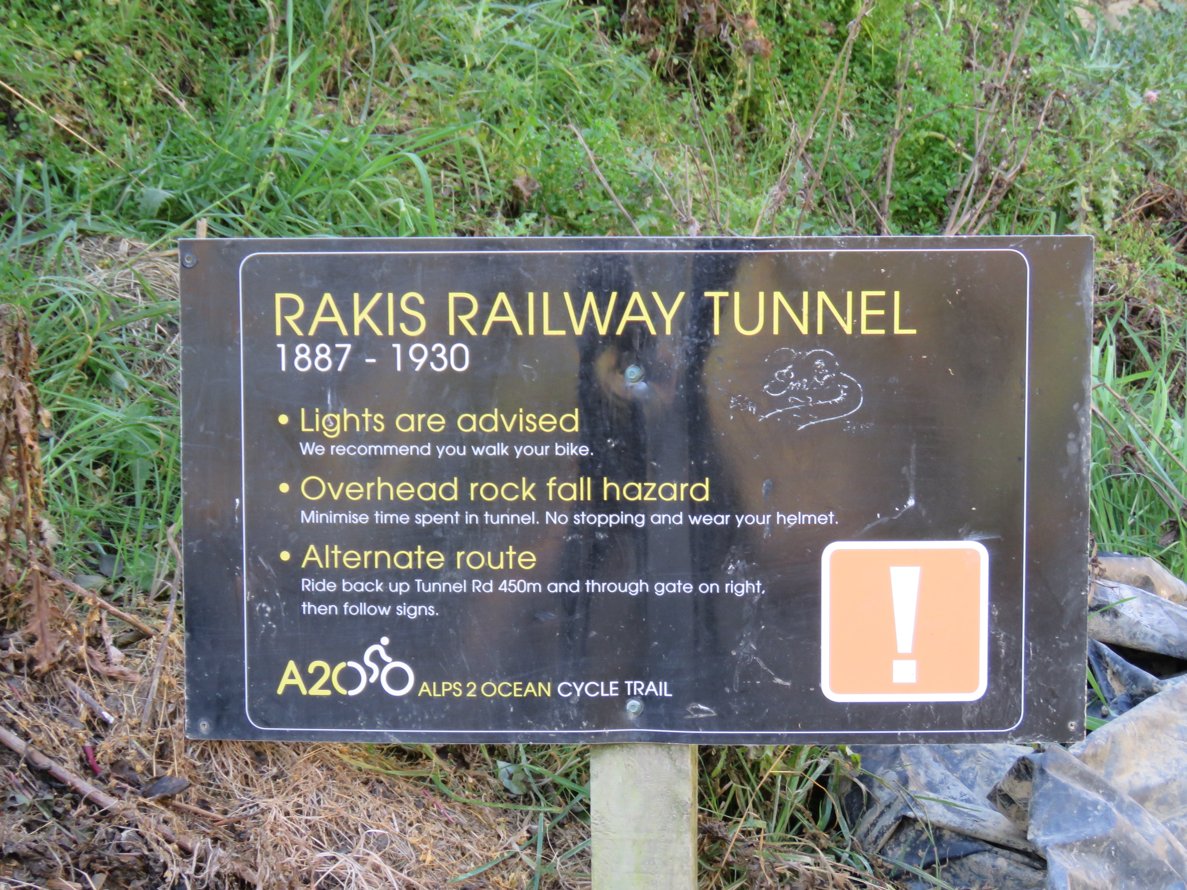
At the western portal is a small Alps to Ocean sign with the name of the railway tunnel, its years of service and due to the nature of the tunnel that lights are recommended and that there is an overhead rock fall hazard.

                            A2O sign at the western portal of the Rakis Tunnel.

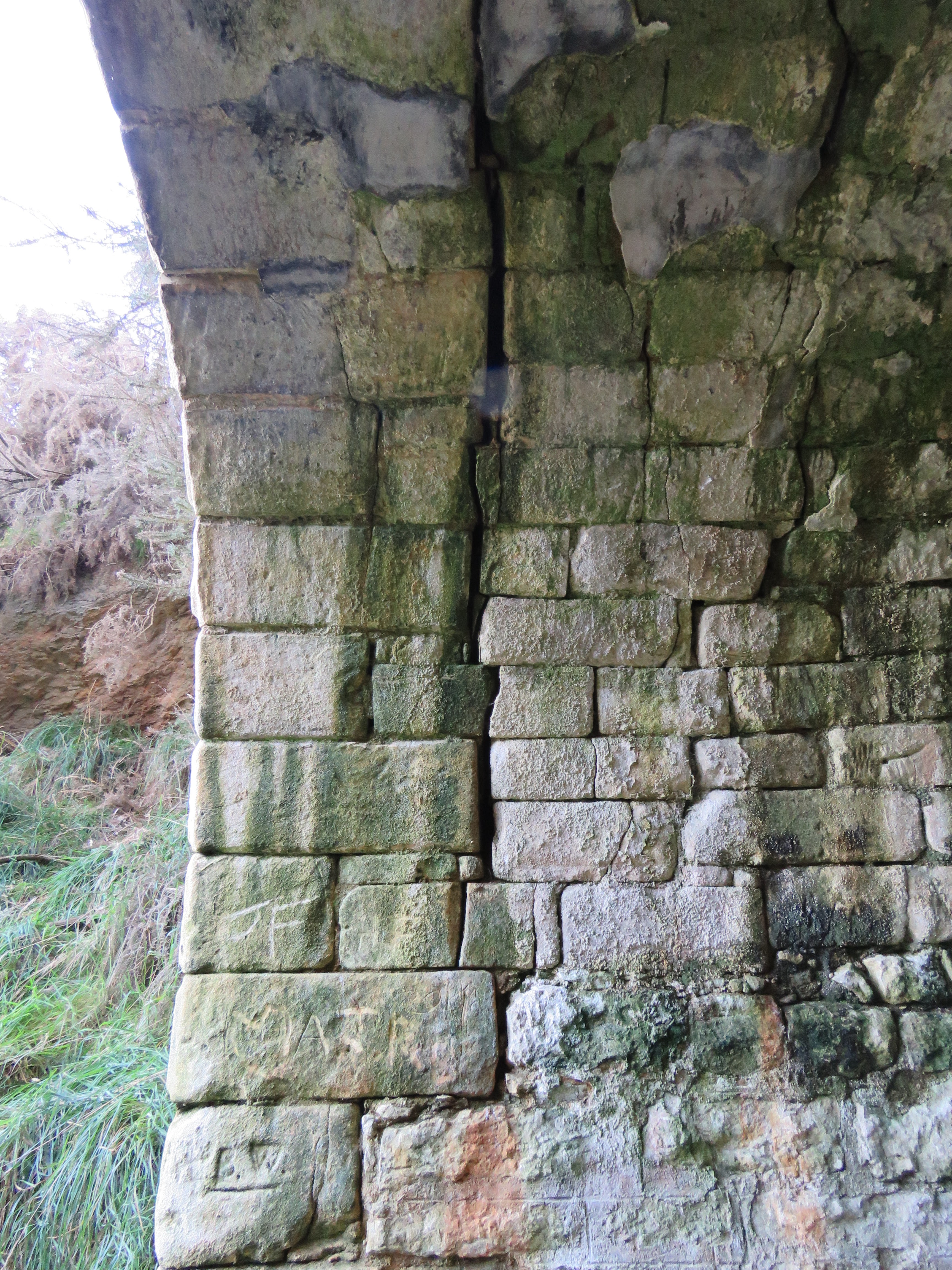
Both portals of the tunnel are constructed of local sand stone.

Western portal of the Rakis Tunnel.


Detail shot of the western portal of the tunnel.

The western end of the portal is very wet with water leaking down through the ceiling of the tunnel and water coming in from outside the portal. Evidence of the water leaks can be seen on the walls of the tunnel especially on the northern side. 


The wet floor and walls at the western end of the tunnel.

While there has been some work done to assist with drainage the constant water leaks make the surface of the tunnel at the western end very slippery and not great for cycling on. I would highly recommend that any cyclist walk through the tunnel to avoid falls.

After passing the wet area at the western end of the tunnel the tunnel floor firms up and is free of water.

Internal detail of the tunnel walls and ceiling.

At about the middle of the tunnel is a niche built into the northern side. railsystem.net defines a niche as 'an area / adit off the main tunnel used for emergency supplies'. I'm not sure the tunnel is quite long enough that it required emergency supplies but was probably constructed for workers to quickly move out of the if caught in the tunnel when a train approached.


The recess in the northern side of the tunnel.

From the niche the tunnel straightens and the eastern portal comes into view.

View looking out from the eastern portal.

As you walk through the eastern portal of the tunnel you can see the brick work of the portal and how it is connected to the tunnel's brick lining.

Brick work at the eastern portal.

On walking outside the eastern portal is of the same sand stone construction as the western portal. Of the two portals this would be in the best condition of the two.

Detail shot of the eastern portal.

From the eastern end of the Rakis tunnel the Alps to Ocean Cycle Trail continues east using the former Tokarahi Branch right of way and parts of the Ngapara Branch as it weaves through North Otago on its way to Oamaru.

Eastern portal of the Rakis Tunnel.

So if you enjoy looking at old branch railway infrastructure, you're in North Otago and can spare an hour or two I would highly recommend a visit to the Rakis Tunnel.

And that's about it.


Monday, September 14, 2015

Otautau's Grain Transfer Facility

Otautau grain transfer facility.

On a recent work trip to Southland I made a little detour through the small Southland town of Otautau. Otautau is a station on the Ohai branch line. The reason I wanted to go through this town was to get some shots of a structure I've been hoping to have a look at for a long time, the Otautau grain transfer facility.

I don't know why but I really like grain facilities. It could be from my youth in Marton that had a number of grain silos and the malting plant or my time in the midwest in the states where every town had an elevator and grain silos.

Either way I just think they look good and this one especially sticks out. While I don't have the space at the moment this is one grain facility that I will build a model of in the future.

So without further ado here are some shots of the Otautau grain facility.


The grain facility hasn't been used for awhile and is starting to look rundown. Looking at the siding leading to the silos it hasn't been used to transfer grain from truck to train for a very, very long time. Would love to see a photo of a wagon being loaded here. 
From a modeling point of view this would look really good with a few V/line VHGF wheat hoppers being loaded.

And thats about it.